Lake Wörthersee Map Poster
The Wörthersee lies long and narrow in its glacial trench — sixteen and a half kilometres from Velden to the eastern bay, where the dead-straight Lendkanal carries on into Klagenfurt. Halfway along, the church peninsula of Maria Wörth steps into the lake from the south shore, with the Pyramidenkogel rising right behind it; south of both, the wooded Sattnitz ridge separates the lake from the Drau valley.
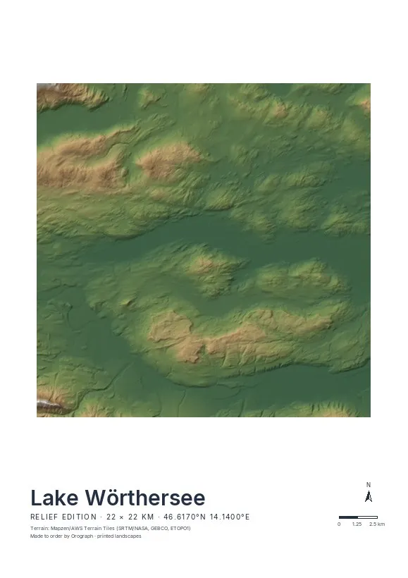
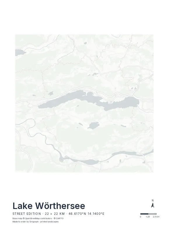
Exact sheet preview — rendered by the same pipeline that produces your print file.
Take the Relief edition: the lake fills a glacier-cut trench, and hillshading shows precisely that — a pale band of water between shaded slopes, with the Sattnitz rolling off the bottom of the sheet toward the Drau. The lake's axis runs almost east–west, so it drops onto a landscape A3 or A2 with hardly any rotation; nudge it a degree or two and the north arrow still points true north. Tighter square crops around Maria Wörth or Pörtschach's twin bays make quiet, symmetrical sheets at 30×30 cm. Put your bathing spot in the title line — Velden, Krumpendorf, Loretto — and a lakeside run prints in signal red from your GPX file.
- Made to order in Austria
- Print-ready files generated for every order
- Free shipping over €120
- A4
- €24
- A3
- €39
- A2
- €59
- 30 × 30 cm
- €29
- 50 × 50 cm
- €49
- Production
- ~3 days
Questions about this poster
Which formats does the Lake Wörthersee poster come in?
A4 (€24), A3 (€39), A2 (€59) in portrait, plus 30 × 30 cm (€29) and 50 × 50 cm (€49) square — printed on matte paper with a title line, coordinates and a scale bar.
Can I choose the map crop myself?
Yes — you frame the crop freely in the configurator, rotate the map to any angle (the north arrow keeps pointing north) and edit the title line. The preview shows the finished sheet before you order.
What is the difference between the editions?
Street is a light, minimal line map without labels; Relief shows the real terrain with hillshading and hypsometric tint from open elevation data; Orthophoto is aerial imagery. You switch live in the preview.
How long do printing and shipping take?
About 3 days of production plus shipping (€6.90, free over €120). Note: the shop is currently a demo — orders generate a real print-ready PDF, but nothing is charged or shipped.
Does the whole lake fit on one sheet?
Comfortably — at 16.5 km long it sits inside the default 22 km frame with Velden and the western edge of Klagenfurt both in view. The instant preview shows the exact crop before you order.
Is Klagenfurt on the sheet as well?
At the default width, the Lendkanal and the city's western districts are in frame. If you want the whole city included, simply shift the crop east in the configurator.
Or map any other place on Earth.
The catalog is inspiration — the globe is the product.