Bern Map Poster
No city sits its old town on the map more elegantly than Bern: the Aare folds into a tight hairpin, and the medieval centre occupies the peninsula inside it — parallel lanes running down the spine like grain in wood. The river wraps three sides in one calm green loop; bridges spring across to Kirchenfeld and the Nydegg side. At the frame's southern edge the Gurten rises, the city's balcony.
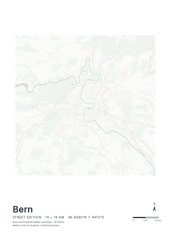
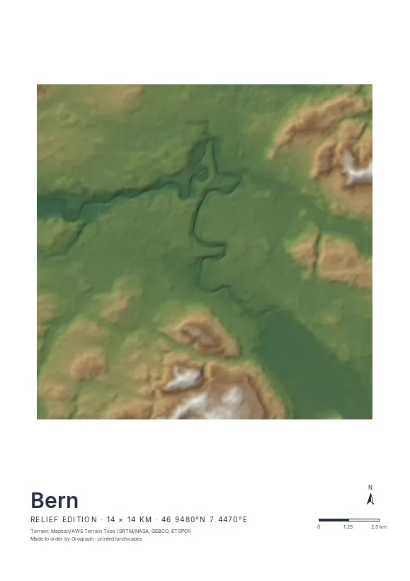
Exact sheet preview — rendered by the same pipeline that produces your print file.
This is the rare city where the tightest crop wins: frame the peninsula with a little river on every side and you have a finished composition, no styling needed. Street renders the loop with graphic clarity — water, bridges, and the ladder of lanes. Relief adds the sandstone drop from the old town down to the Aare and the Gurten's swell, worth it if you widen the view. Rotating the map a few degrees to lay the peninsula horizontal is the move almost everyone makes; the north arrow keeps the record straight. A4 makes a fine gift, A2 turns the loop into the room's centrepiece.
- Made to order in Austria
- Print-ready files generated for every order
- Free shipping over €120
- A4
- €24
- A3
- €39
- A2
- €59
- 30 × 30 cm
- €29
- 50 × 50 cm
- €49
- Production
- ~3 days
Questions about this poster
Which formats does the Bern poster come in?
A4 (€24), A3 (€39), A2 (€59) in portrait, plus 30 × 30 cm (€29) and 50 × 50 cm (€49) square — printed on matte paper with a title line, coordinates and a scale bar.
Can I choose the map crop myself?
Yes — you frame the crop freely in the configurator, rotate the map to any angle (the north arrow keeps pointing north) and edit the title line. The preview shows the finished sheet before you order.
What is the difference between the editions?
Street is a light, minimal line map without labels; Relief shows the real terrain with hillshading and hypsometric tint from open elevation data; Orthophoto is aerial imagery. You switch live in the preview.
How long do printing and shipping take?
About 3 days of production plus shipping (€6.90, free over €120). Note: the shop is currently a demo — orders generate a real print-ready PDF, but nothing is charged or shipped.
What is the classic Bern crop?
The Aare loop, centred, with the peninsula laid horizontal — a square 30 × 30 or 50 × 50 cm sheet frames the hairpin almost perfectly. Try it in the live preview.
Can I print my Aare swim route?
Yes — upload a GPX track and it prints in signal red. The float from Eichholz down to the Marzili is a short, very Bernese line.
Or map any other place on Earth.
The catalog is inspiration — the globe is the product.