Lake Constance Map Poster
Lake Constance is really two lakes wearing one name: the broad Obersee and the branching Untersee, joined by a short stretch of Rhine at Konstanz. The Rhine builds the lake and drains it — entering through its delta near Bregenz, leaving again at Stein am Rhein. On a relief map the setting does the talking: the Alpstein wall rising close behind the southern shore, and the soft moraine country rolling away to the north.
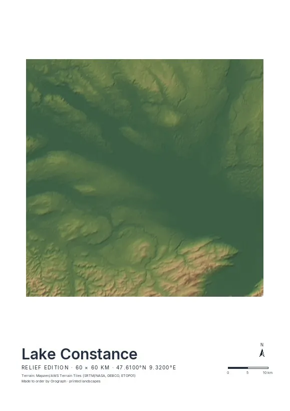
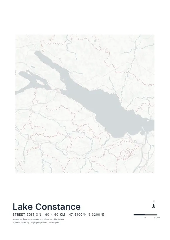
Exact sheet preview — rendered by the same pipeline that produces your print file.
Order this one in the Relief edition: the hypsometric tint keeps the water one calm plane while hillshading lifts the Alpstein and the Bregenzerwald from the southern edge — this is exactly the terrain the edition was made for. Rotate the map a few degrees so the lake's long axis runs with the sheet; the north arrow keeps pointing true north regardless. On A2 or the 50×50 cm square, the full sweep from Bregenz to the Untersee has room to breathe, plus a title line for a harbour town or a sailing date. And if you have cycled the lake loop, the GPX track prints in signal red.
- Made to order in Austria
- Print-ready files generated for every order
- Free shipping over €120
- A4
- €24
- A3
- €39
- A2
- €59
- 30 × 30 cm
- €29
- 50 × 50 cm
- €49
- Production
- ~3 days
Questions about this poster
Which formats does the Lake Constance poster come in?
A4 (€24), A3 (€39), A2 (€59) in portrait, plus 30 × 30 cm (€29) and 50 × 50 cm (€49) square — printed on matte paper with a title line, coordinates and a scale bar.
Can I choose the map crop myself?
Yes — you frame the crop freely in the configurator, rotate the map to any angle (the north arrow keeps pointing north) and edit the title line. The preview shows the finished sheet before you order.
What is the difference between the editions?
Street is a light, minimal line map without labels; Relief shows the real terrain with hillshading and hypsometric tint from open elevation data; Orthophoto is aerial imagery. You switch live in the preview.
How long do printing and shipping take?
About 3 days of production plus shipping (€6.90, free over €120). Note: the shop is currently a demo — orders generate a real print-ready PDF, but nothing is charged or shipped.
Does the whole lake fit on one sheet?
Yes — Lake Constance measures about 63 km from Bregenz to Stein am Rhein. Widen the crop slightly or rotate the map into the lake's axis and everything fits; the instant preview confirms the frame before you order.
Do Mainau, Reichenau and Lindau show?
All three islands print clearly at this scale, on the Relief edition as well as the Street edition — Lindau sitting just off the northern shore, Reichenau inside the Untersee.
Nearby on the shelf
Or map any other place on Earth.
The catalog is inspiration — the globe is the product.