Stuttgart Map Poster
Stuttgart is the rare city where a relief map explains more than a street map: the centre sits in a deep basin — the Kessel — and the streets climb out of it in switchbacks and stairways toward Degerloch and the Killesberg. The Neckar never enters the bowl; it keeps to the northeast, passing Bad Cannstatt in a wide arc. A 16 km frame shows both: the dense valley floor and the vineyards banking above it.
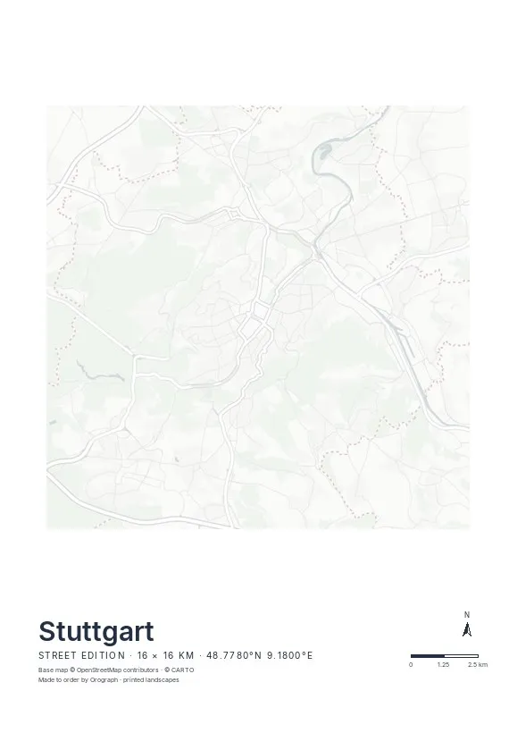
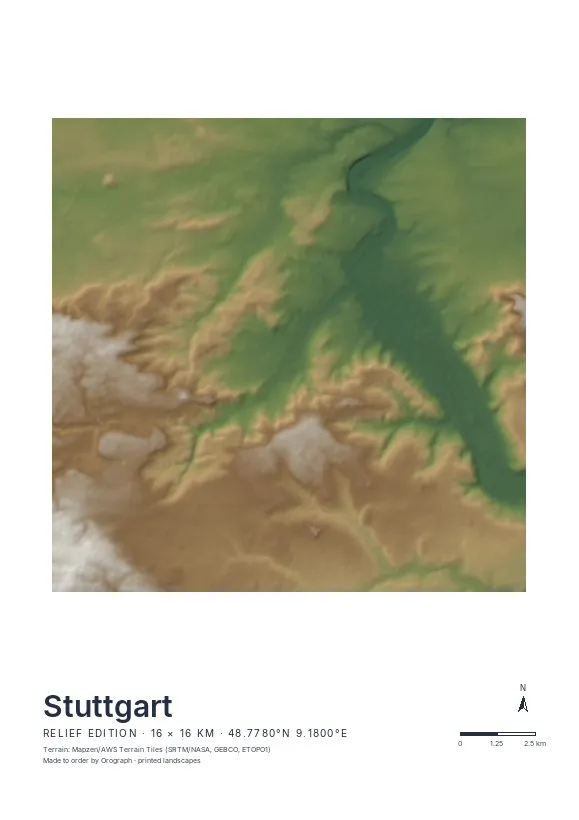
Exact sheet preview — rendered by the same pipeline that produces your print file.
Choose the Relief edition here: hillshading from real elevation data renders the Kessel as a shadowed bowl and the Neckar valley as a second, softer trench beside it — few cities gain this much from terrain. On the Street edition, the hairpin climbs of the Neue Weinsteige give the sheet its signature instead. Center between Schlossplatz and Marienplatz, keep some hillside in frame, and A3 or A2 gives the slopes room to work. Rotate freely if you would rather have the valley run upright — the north arrow stays honest — and put a date or a Stäffele count in the editable title line.
- Made to order in Austria
- Print-ready files generated for every order
- Free shipping over €120
- A4
- €24
- A3
- €39
- A2
- €59
- 30 × 30 cm
- €29
- 50 × 50 cm
- €49
- Production
- ~3 days
Questions about this poster
Which formats does the Stuttgart poster come in?
A4 (€24), A3 (€39), A2 (€59) in portrait, plus 30 × 30 cm (€29) and 50 × 50 cm (€49) square — printed on matte paper with a title line, coordinates and a scale bar.
Can I choose the map crop myself?
Yes — you frame the crop freely in the configurator, rotate the map to any angle (the north arrow keeps pointing north) and edit the title line. The preview shows the finished sheet before you order.
What is the difference between the editions?
Street is a light, minimal line map without labels; Relief shows the real terrain with hillshading and hypsometric tint from open elevation data; Orthophoto is aerial imagery. You switch live in the preview.
How long do printing and shipping take?
About 3 days of production plus shipping (€6.90, free over €120). Note: the shop is currently a demo — orders generate a real print-ready PDF, but nothing is charged or shipped.
Does the Kessel really show on the Relief edition?
Yes — from the valley floor to the surrounding heights is roughly 250 metres, well within what the hillshade picks up. The bowl reads instantly, even at A4.
Is the Neckar on the sheet?
With the default 16 km frame, yes — it passes Bad Cannstatt in the northeast. Shift the crop east in the configurator if you want the river more central; the preview updates instantly.
Or map any other place on Earth.
The catalog is inspiration — the globe is the product.