Zurich Map Poster
Zurich's map is really the story of a lake becoming a river: the Zürichsee narrows to its tip, hands its water to the Limmat, and the old town crowds both banks of the handover. The Sihl sneaks in from the south-west to meet the Limmat behind the main station, the Bahnhofstrasse links station and shore in one straight line, and the Uetliberg closes the frame to the west.
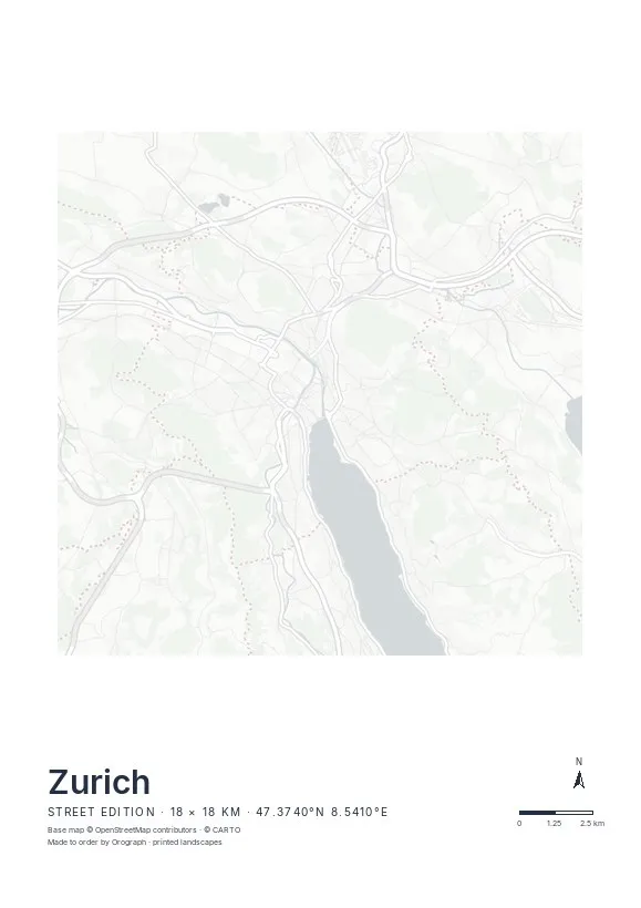
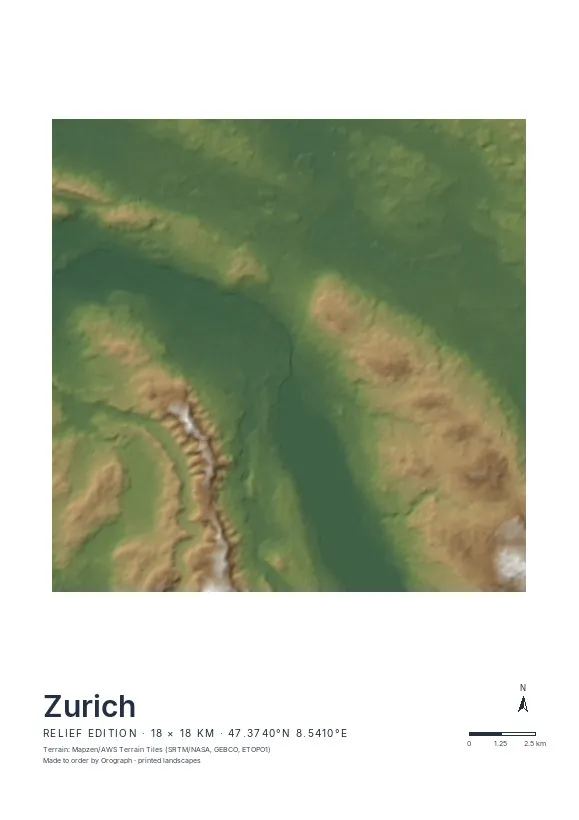
Exact sheet preview — rendered by the same pipeline that produces your print file.
The strongest crop puts the lake tip in the lower third and lets the Limmat run up the sheet, with Niederdorf's tangle on one bank and the Lindenhof side on the other. Street is the classic Zurich choice — water and lanes carry it without a single label. Relief earns its place on a wider frame, shading the Uetliberg and the Zürichberg into the composition and turning the lake basin into a visible trough. Rotate a few degrees so the shoreline sits level, keep the coordinates and scale bar as quiet proof of place, and go A2 if you want both hills; A4 or 30 × 30 cm handle the centre alone.
- Made to order in Austria
- Print-ready files generated for every order
- Free shipping over €120
- A4
- €24
- A3
- €39
- A2
- €59
- 30 × 30 cm
- €29
- 50 × 50 cm
- €49
- Production
- ~3 days
Questions about this poster
Which formats does the Zurich poster come in?
A4 (€24), A3 (€39), A2 (€59) in portrait, plus 30 × 30 cm (€29) and 50 × 50 cm (€49) square — printed on matte paper with a title line, coordinates and a scale bar.
Can I choose the map crop myself?
Yes — you frame the crop freely in the configurator, rotate the map to any angle (the north arrow keeps pointing north) and edit the title line. The preview shows the finished sheet before you order.
What is the difference between the editions?
Street is a light, minimal line map without labels; Relief shows the real terrain with hillshading and hypsometric tint from open elevation data; Orthophoto is aerial imagery. You switch live in the preview.
How long do printing and shipping take?
About 3 days of production plus shipping (€6.90, free over €120). Note: the shop is currently a demo — orders generate a real print-ready PDF, but nothing is charged or shipped.
How much of the lake should I include?
The tip is enough — the taper into the Limmat is what makes the composition. If you want more water, shift the crop south in the configurator and let the lake fill the lower half; the preview updates instantly.
Does the water read well in the Street edition?
Yes — the lake tip and the Limmat print as calm, unbroken shapes against the fine line work, so the water is the first thing the eye finds.
Or map any other place on Earth.
The catalog is inspiration — the globe is the product.