Dresden Map Poster
The Elbe crosses Dresden in wide, unhurried arcs, and along almost its entire course the banks stay open: the Elbwiesen, riverside meadows never built over, run like a soft corridor between Altstadt and Neustadt and out towards the vineyards of Loschwitz. On the map this reads beautifully — a broad ribbon of river and meadow sweeping through dense quarters, with the slopes of the Elbe valley rising on either side.
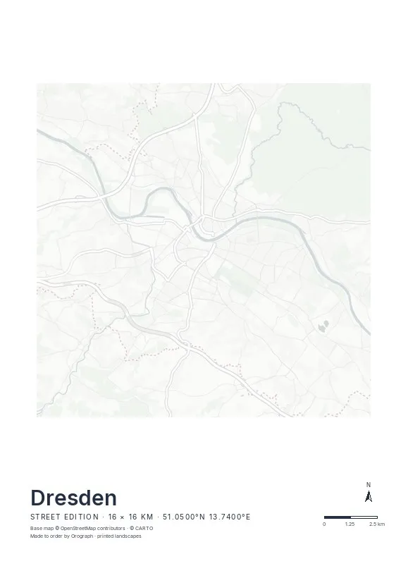
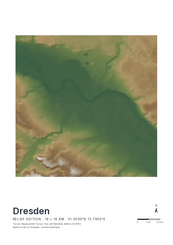
Exact sheet preview — rendered by the same pipeline that produces your print file.
Dresden is one of the rare German cities where the Relief edition earns its keep: hillshading brings out the valley basin, the rise toward the Dresdner Heide in the north-east and the steep right-bank slopes near Loschwitz and the Blaues Wunder bridge. A 16 km span holds all of it; a tighter crop on the inner city sets Altstadt and Neustadt symmetrically across the river. Rotate the sheet to lay the Elbe on the diagonal, add a title of your own, and fine-tune everything in the live preview. Printed on museum-grade paper in A4 to A2 and two square formats.
- Made to order in Austria
- Print-ready files generated for every order
- Free shipping over €120
- A4
- €24
- A3
- €39
- A2
- €59
- 30 × 30 cm
- €29
- 50 × 50 cm
- €49
- Production
- ~3 days
Questions about this poster
Which formats does the Dresden poster come in?
A4 (€24), A3 (€39), A2 (€59) in portrait, plus 30 × 30 cm (€29) and 50 × 50 cm (€49) square — printed on matte paper with a title line, coordinates and a scale bar.
Can I choose the map crop myself?
Yes — you frame the crop freely in the configurator, rotate the map to any angle (the north arrow keeps pointing north) and edit the title line. The preview shows the finished sheet before you order.
What is the difference between the editions?
Street is a light, minimal line map without labels; Relief shows the real terrain with hillshading and hypsometric tint from open elevation data; Orthophoto is aerial imagery. You switch live in the preview.
How long do printing and shipping take?
About 3 days of production plus shipping (€6.90, free over €120). Note: the shop is currently a demo — orders generate a real print-ready PDF, but nothing is charged or shipped.
Street or Relief for Dresden?
Both work, which is unusual. Street turns the Elbe arc and the unbuilt meadows into a calm graphic figure; Relief adds the valley basin and the Loschwitz slopes in shaded tints. If your crop reaches the city edges, Relief shows more.
What's a good crop beyond the old town?
Try centring on the Blaues Wunder: the bridge, the villa quarters of Blasewitz and Loschwitz and the steep vineyard slopes make an intimate, very Dresden composition.
Nearby on the shelf
Or map any other place on Earth.
The catalog is inspiration — the globe is the product.