Innsbruck Map Poster
Innsbruck's map has a wall along the top: the Nordkette rises straight from the northern edge of town — the last streets end against its lower slopes. The Inn runs west to east across the frame, and Maria-Theresien-Straße aims due north at the ridge; the view that stops every visitor mid-stride is already there in the geometry of the plan.
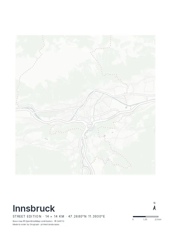
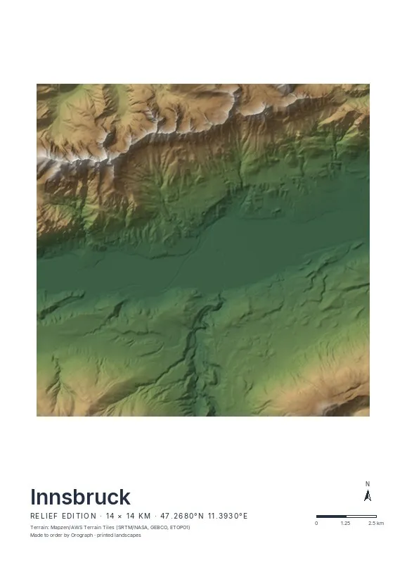
Exact sheet preview — rendered by the same pipeline that produces your print file.
At 14 km the frame holds the whole valley floor from the Bergisel ski jump to the Hungerburg terrace; crop tighter to the old town and the Inn if you prefer streets over slopes. Relief is the obvious edition — the hypsometric tint shows the valley as a green ribbon between rising flanks, and the Nordkette becomes the poster's dramatic upper third. Street plays it quieter: the medieval knot by the river against Wilten's orderly blocks. Rotation matters little here, since the valley already runs conveniently west to east — so spend your choices on the title line and the format; A2 in portrait gives the mountains headroom. Innsbruck is also available as a 3D relief.
- Made to order in Austria
- Print-ready files generated for every order
- Free shipping over €120
- A4
- €24
- A3
- €39
- A2
- €59
- 30 × 30 cm
- €29
- 50 × 50 cm
- €49
- Production
- ~3 days
Questions about this poster
Which formats does the Innsbruck poster come in?
A4 (€24), A3 (€39), A2 (€59) in portrait, plus 30 × 30 cm (€29) and 50 × 50 cm (€49) square — printed on matte paper with a title line, coordinates and a scale bar.
Can I choose the map crop myself?
Yes — you frame the crop freely in the configurator, rotate the map to any angle (the north arrow keeps pointing north) and edit the title line. The preview shows the finished sheet before you order.
What is the difference between the editions?
Street is a light, minimal line map without labels; Relief shows the real terrain with hillshading and hypsometric tint from open elevation data; Orthophoto is aerial imagery. You switch live in the preview.
How long do printing and shipping take?
About 3 days of production plus shipping (€6.90, free over €120). Note: the shop is currently a demo — orders generate a real print-ready PDF, but nothing is charged or shipped.
Does the Nordkette fit on the poster?
In the Relief edition, yes — a 14 km frame centred slightly south of the old town takes in the full ridgeline up to Hafelekar. Slide the crop in the configurator until the crest sits where you want it.
Is the Street edition too empty for a mountain town?
No — without labels, the contrast between the tight old-town knot, the Inn and the abrupt end of the street grid at the valley edge is exactly the point.
Or map any other place on Earth.
The catalog is inspiration — the globe is the product.