Lake Chiemsee Map Poster
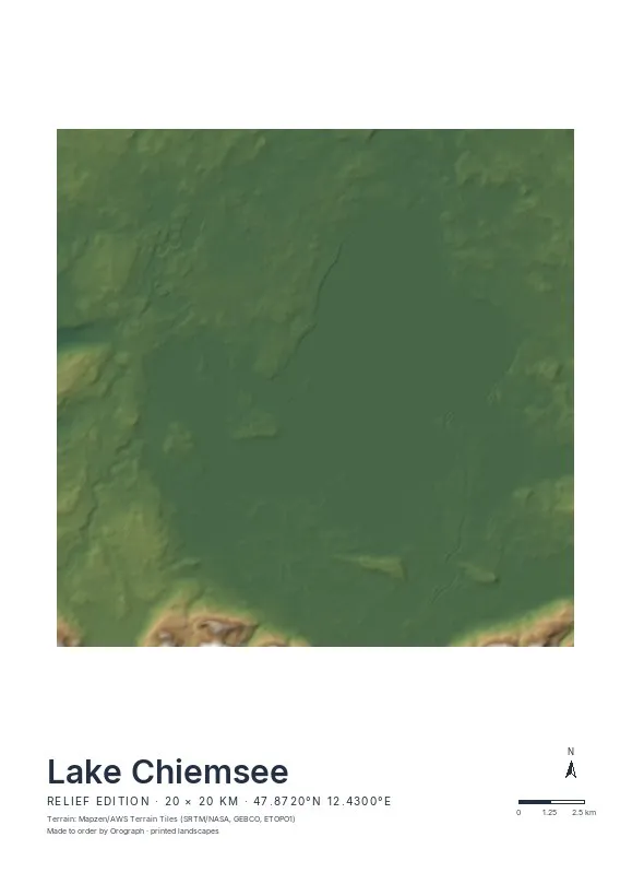
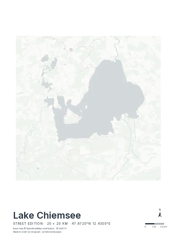
The Chiemsee announces the Alps: its southern shore is a delta still growing, where the Tiroler Achen pushes silt into the lake, and directly behind it the Chiemgau peaks stand up — flat water and mountain wall on one sheet. Out in the lake, Herreninsel and Fraueninsel float barely more than a kilometre apart, and at the northern end the Alz slips out at Seebruck, the lake's only outflow.
Exact sheet preview — rendered by the same pipeline that produces your print file.
Relief is the edition this lake was waiting for: hypsometric tint keeps the water pale and level while the Kampenwand and its neighbours darken and rise along the bottom edge of the sheet. A 20 km frame catches the whole lake with the mountain wall as its base line; rotate it slightly if you want the delta dead centre — the north arrow will not lie to you. The square 50×50 cm format suits the lake's roundish outline, while A3 and A2 add more of the foothills. Set the title line to your shore — Chieming, Prien, Gstadt — and add a sailing or swimming GPX track in signal red.
- Made to order in Austria
- Print-ready files generated for every order
- Free shipping over €120
- A4
- €24
- A3
- €39
- A2
- €59
- 30 × 30 cm
- €29
- 50 × 50 cm
- €49
- Production
- ~3 days
Questions about this poster
Which formats does the Lake Chiemsee poster come in?
A4 (€24), A3 (€39), A2 (€59) in portrait, plus 30 × 30 cm (€29) and 50 × 50 cm (€49) square — printed on matte paper with a title line, coordinates and a scale bar.
Can I choose the map crop myself?
Yes — you frame the crop freely in the configurator, rotate the map to any angle (the north arrow keeps pointing north) and edit the title line. The preview shows the finished sheet before you order.
What is the difference between the editions?
Street is a light, minimal line map without labels; Relief shows the real terrain with hillshading and hypsometric tint from open elevation data; Orthophoto is aerial imagery. You switch live in the preview.
How long do printing and shipping take?
About 3 days of production plus shipping (€6.90, free over €120). Note: the shop is currently a demo — orders generate a real print-ready PDF, but nothing is charged or shipped.
Do the islands show at this scale?
Clearly. Herreninsel covers over two square kilometres, and even Fraueninsel's small oval prints distinctly on every format from A4 up.
Which edition shows the Alps best?
Relief — the hillshade renders the Chiemgau wall south of the lake in real light and shadow, with hypsometric tint separating foothills from summits. The Street edition leaves that same area almost empty.
Or map any other place on Earth.
The catalog is inspiration — the globe is the product.