Vienna Map Poster
On the map, Vienna reads as a set of rings: the Ringstrasse traces the line of the old city walls, the Gürtel draws a second loop around it, and the districts fan outward between radial avenues. The Danube crosses the north-east as a band of parallel lines — the river, the New Danube, and the long sliver of the Danube Island between them — while the Danube Canal peels off to skirt the first district.
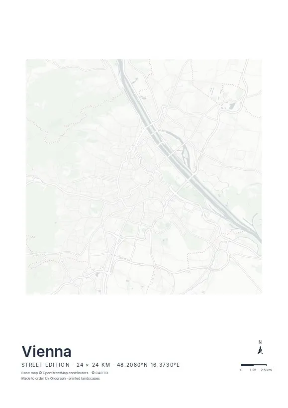
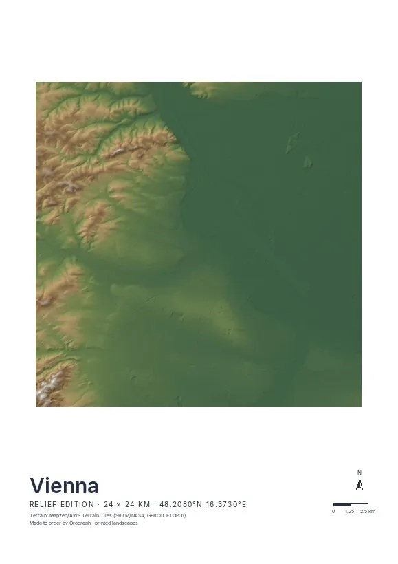
Exact sheet preview — rendered by the same pipeline that produces your print file.
The classic crop centres the first district, where the Ringstrasse draws its horseshoe and the Danube Canal closes the loop — it sits beautifully on a 30 × 30 or 50 × 50 cm square. For the whole city, A2 gives the Gürtel and the Danube room to breathe. The Street edition suits Vienna best: no labels, just the contrast between the medieval tangle inside the Ring and the planned blocks outside it. Choose Relief if you want the Wienerwald's slopes shading the western districts. Rotate the map to lay the canal horizontal — the north arrow keeps its bearing — and put your own line in the title, a district name or a date. Vienna is also available as a 3D relief.
- Made to order in Austria
- Print-ready files generated for every order
- Free shipping over €120
- A4
- €24
- A3
- €39
- A2
- €59
- 30 × 30 cm
- €29
- 50 × 50 cm
- €49
- Production
- ~3 days
Questions about this poster
Which formats does the Vienna poster come in?
A4 (€24), A3 (€39), A2 (€59) in portrait, plus 30 × 30 cm (€29) and 50 × 50 cm (€49) square — printed on matte paper with a title line, coordinates and a scale bar.
Can I choose the map crop myself?
Yes — you frame the crop freely in the configurator, rotate the map to any angle (the north arrow keeps pointing north) and edit the title line. The preview shows the finished sheet before you order.
What is the difference between the editions?
Street is a light, minimal line map without labels; Relief shows the real terrain with hillshading and hypsometric tint from open elevation data; Orthophoto is aerial imagery. You switch live in the preview.
How long do printing and shipping take?
About 3 days of production plus shipping (€6.90, free over €120). Note: the shop is currently a demo — orders generate a real print-ready PDF, but nothing is charged or shipped.
Is the Danube Island inside the default crop?
Yes — at 24 km across, the frame takes in the river, the New Danube and the island between them. If you want the island as the centrepiece, drag the crop north-east in the configurator and check the preview.
Street or Relief for Vienna?
Vienna is mostly flat, so Street is the usual pick — the ring-and-radial pattern carries the poster. Relief pays off if your crop includes the western edge, where the Wienerwald rises.
Or map any other place on Earth.
The catalog is inspiration — the globe is the product.