Hamburg Map Poster
Hamburg is a city drawn by water. The Elbe splits into two arms around the island of Wilhelmsburg, harbour basins cut comb-like into the southern bank, and in the middle of it all the dammed Alster forms two lakes — the small Binnenalster framed by the city, the wide Außenalster ringed by sails in summer. Add the canals of the Speicherstadt and you have a street map that reads like a chart.
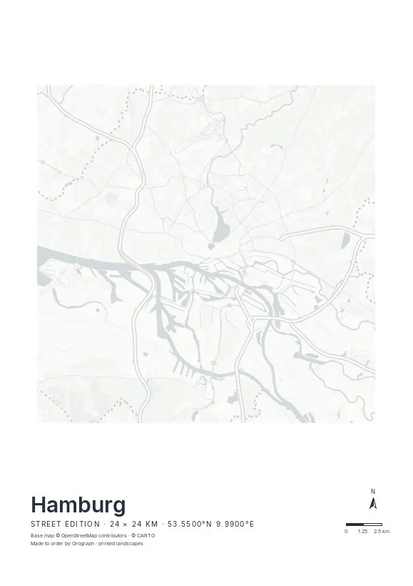
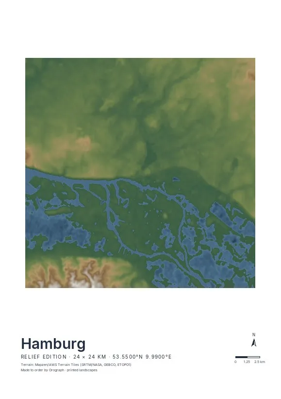
Exact sheet preview — rendered by the same pipeline that produces your print file.
The full 24 km span balances the two Alster lakes against the port — water in the north, docks in the south, the Elbe running diagonally between them. For a tighter piece, frame the Speicherstadt and HafenCity, where the canal pattern is densest. Choose the Street edition: Hamburg's character lies entirely in the meeting of grid and water, and the minimal line map renders every basin and canal crisply. Rotate the sheet so the Elbe runs level, name the title line after your quarter, and preview the result live. Formats range from A4 to A2, plus 30×30 and 50×50 cm squares.
- Made to order in Austria
- Print-ready files generated for every order
- Free shipping over €120
- A4
- €24
- A3
- €39
- A2
- €59
- 30 × 30 cm
- €29
- 50 × 50 cm
- €49
- Production
- ~3 days
Questions about this poster
Which formats does the Hamburg poster come in?
A4 (€24), A3 (€39), A2 (€59) in portrait, plus 30 × 30 cm (€29) and 50 × 50 cm (€49) square — printed on matte paper with a title line, coordinates and a scale bar.
Can I choose the map crop myself?
Yes — you frame the crop freely in the configurator, rotate the map to any angle (the north arrow keeps pointing north) and edit the title line. The preview shows the finished sheet before you order.
What is the difference between the editions?
Street is a light, minimal line map without labels; Relief shows the real terrain with hillshading and hypsometric tint from open elevation data; Orthophoto is aerial imagery. You switch live in the preview.
How long do printing and shipping take?
About 3 days of production plus shipping (€6.90, free over €120). Note: the shop is currently a demo — orders generate a real print-ready PDF, but nothing is charged or shipped.
Does the harbour read well in the Street edition?
Yes — the basins and quays south of the Elbe print as fine, precise linework, and water stays a calm surface, so the port's comb-like structure becomes the most striking part of the sheet.
Should I include both Alster lakes or just the port?
The classic Hamburg crop holds both: Außenalster at the top, harbour at the bottom, the Elbe cutting through between. If you have to choose, a square 50×50 cm sheet centred between Landungsbrücken and Binnenalster keeps the essentials.
Nearby on the shelf
Or map any other place on Earth.
The catalog is inspiration — the globe is the product.